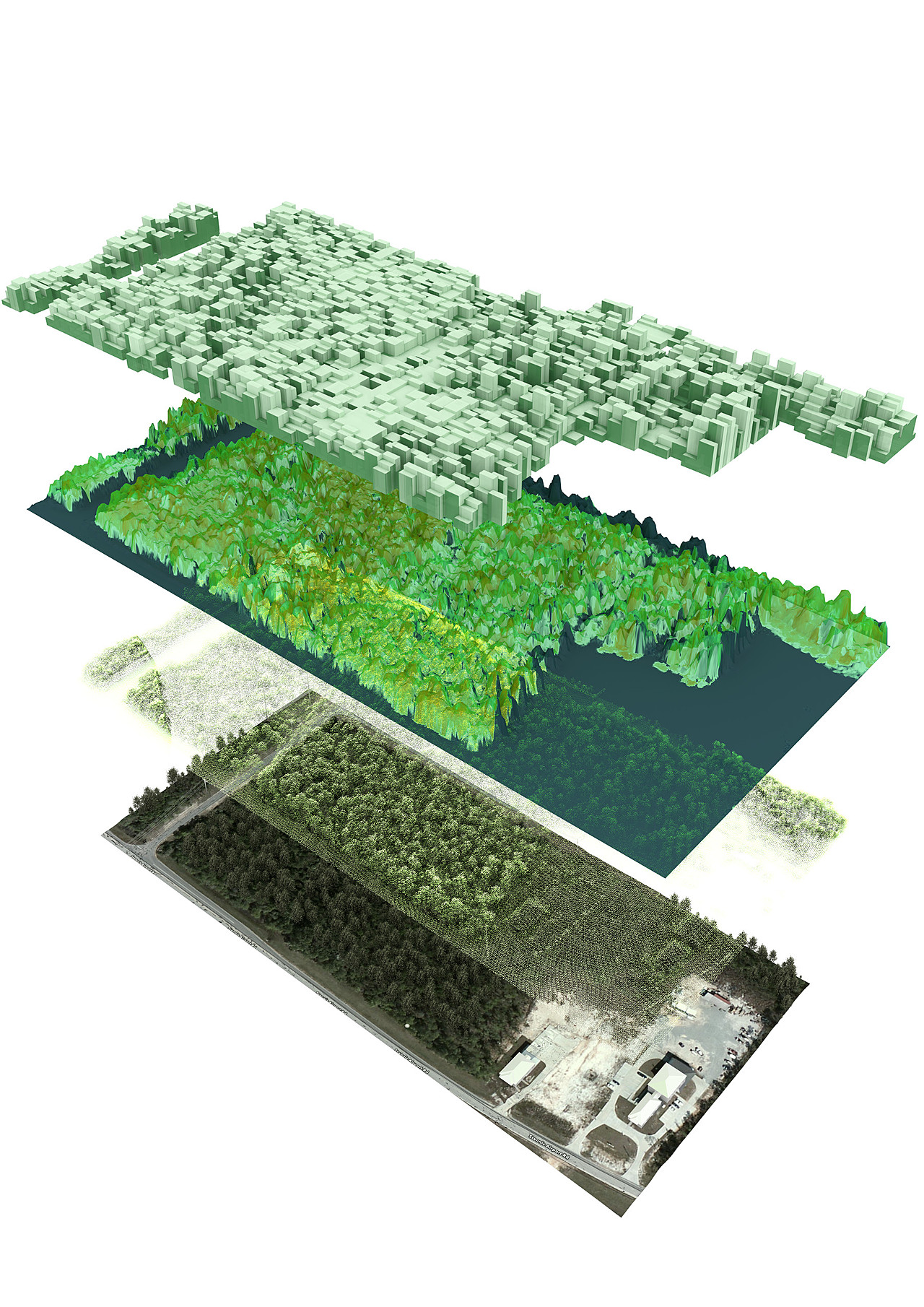
We had some points cloud data coming from an airborne sensor. We wanted to use that data set to present our activity.
The points cloud is the original data. We had to develop a script in order to render points into cycles.
From the points cloud we recreated the 3D scene, bottom layer. Particle system has been used for the forest, with density and height extracted directly from the points cloud. We used Google Map image for the texture. There are some mismatch between the 3D scene and the texture because the Google Map image are not properly georectify.
The two upper layer reflect the data processing and metrics production we can do from the points cloud. For instance the third layer from bottom is the canopy height model and the upper layer is the carbon content.
Everything modelled in Blender 2.70 and render with Cycles.